West Parry Sound Geography Network

Interactive Mapping
An interactive mapping application developed collaboratively by seven municipalities, providing comprehensive spatial data, maps, and analytical resources to support informed decision-making across West Parry Sound.

WPSGN Data warehouse
An expansive open data portal/datawarehouse providing unrestricted access to a wealth of diverse datasets, fostering transparency, innovation, and community engagement across West Parry Sound.

Support
Explore our tutorials, your go-to resource for comprehensive tutorials, troubleshooting guides, and more, ensuring you have all the tools and knowledge needed for seamless navigation and optimal usage.

System Health
To insure seamless functionality, view out system health page to highlight issues such as server downtimes or issues with software vendors. Included here is our development log.

Open Data Portal
An expansive open data portal/datawarehouse providing unrestricted access to a wealth of diverse datasets, fostering transparency, innovation, and community engagement across West Parry Sound.

Ortho-photography
Discover a comprehensive orthophotography repository featuring high-resolution aerial images meticulously curated for geographic analysis, planning, and environmental monitoring

IM v6 Tutorial
A Complete list of instructions on using our main WPSGN GIS/Interactive Mapping application (IM).

Field Maps Tutorial
The main WPSGN GIS/IM Version 6 is designed for desktop use. Depending on the information needed, downloading the Field Maps application may render a better mobile experience.

Quick Capture App
Instructions to download this app to your decive to map features in the field. eg. stream digitize a new road, or capture feature locations...

Parcel Boundaries
How accurate are the Parcel Boundaries? Everything you need to know about the accuracy of the parcel boundaries on the West Parry Sound Geography Network.



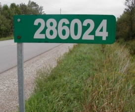







 Civic Address or Road Update Form for Staff